Need to Assess
Vapor Migration Risk?
Our user-friendly VEC App Tool is embedded in
Envirosite Atlas® at no charge.
Environmental Data You Can
Trust, Experienced Through
Next-Gen Workflow Platforms
Whatever your project, we have the data to support your needs:
- Environmental Risk Management
- Phase I & Phase II Environmental Site Assessments
- RSRA/Desktop Reviews
- Area & Corridor Studies
- Transactional Screening
- Renewable Energy Projects
Access over 2,000 comprehensive data sets, get your reports delivered quickly, and experience top notch customer service.
Our Products and Solutions
Our reports meet ASTM E1527-21 Phase I Standard requirements.
Always get the data the way you want it with customizable reports and packages.

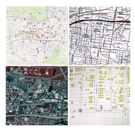
Area and Corridor Studies
Our Area & Corridor Study reports are designed to support all large area and linear corridor projects that are greater than 1 mile — including non-contiguous projects.
LEARN MORE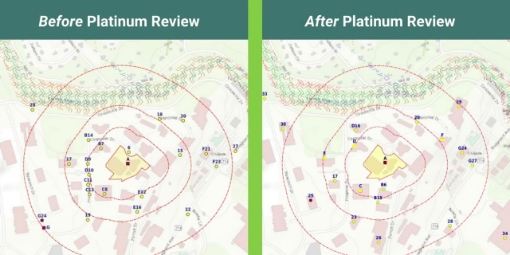
Platinum Review
A manual review service that saves environmental professionals time spent validating site locations and distances during report writing and analysis.
LEARN MORE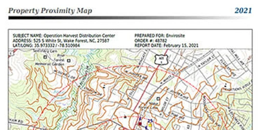
Government Environmental Records
Provides ASTM E1527-21 and "All Appropriate Inquiry" (AAI) compliant data that assists in identifying existing or potential environmental concerns–a requirement for many commercial real estate transactions.
LEARN MORE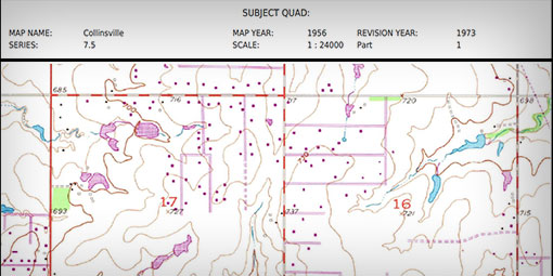
Historic Topographic Maps
Topographic maps to serve as trusted historical resources and are used frequently to aid in the environmental site assessment process.
LEARN MORE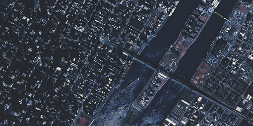
Historic Aerial Photos
Historic Aerial Photos are acquired from a variety of sources to provide quality land use imagery that spans decades to aid you in your environmental investigations.
LEARN MORE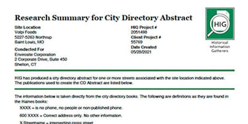
City Directories
A valuable historical research tool, our City Directories Report leverages a proprietary database of over one billion records to identify current and former occupants, owners, business names and prior use of specific addresses of properties over of time.
LEARN MORE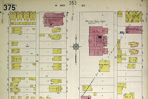
Fire Insurance Maps
Fire Insurance Maps date back over a century and are rich with valuable detailed information, depicting urban and industrial areas, building footprints and construction.
LEARN MORE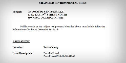
Environmental Lien & AUL Report
Environmental Lien & AUL Reports help determine if there are any debts attached to the title of a property or debts that had previously been attached.
LEARN MORE
Chain of Title Report
A valuable tool to identify and document past owners of a property. Serving as a property’s historical ownership timeline it is based on local land records.
LEARN MORE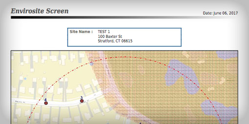
Envirosite Screen
Quickly view properties for potential environmental risks and issues. This is the perfect solution for lenders, investors, and insurers who need concise, easy to synthesize information.
LEARN MORE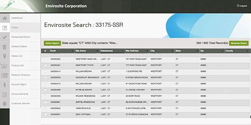
Envirosite Search
Searches over 2,000 databases and provides on-demand 24/7 property/site or company research allowing you to respond quickly to shifting priorities.
LEARN MORESeeing is Believing
Take Envirosite for a Spin.
Want a personalized demo of our platforms, VEC App Tool or product suite? Reach out to us at anytime.
The Envirosite Advantage
Envirosite’s highly motivated team is made up of industry leaders with over two decades of
extensive experience in the environmental data and solutions market.
Comprehensive
Quality Reporting
Providing environmental data you can trust.
Shortest
Time-To-Insight
Delivering the fastest turnaround times in the industry.
Unparalleled Service
Supporting clients with top notch customer service.
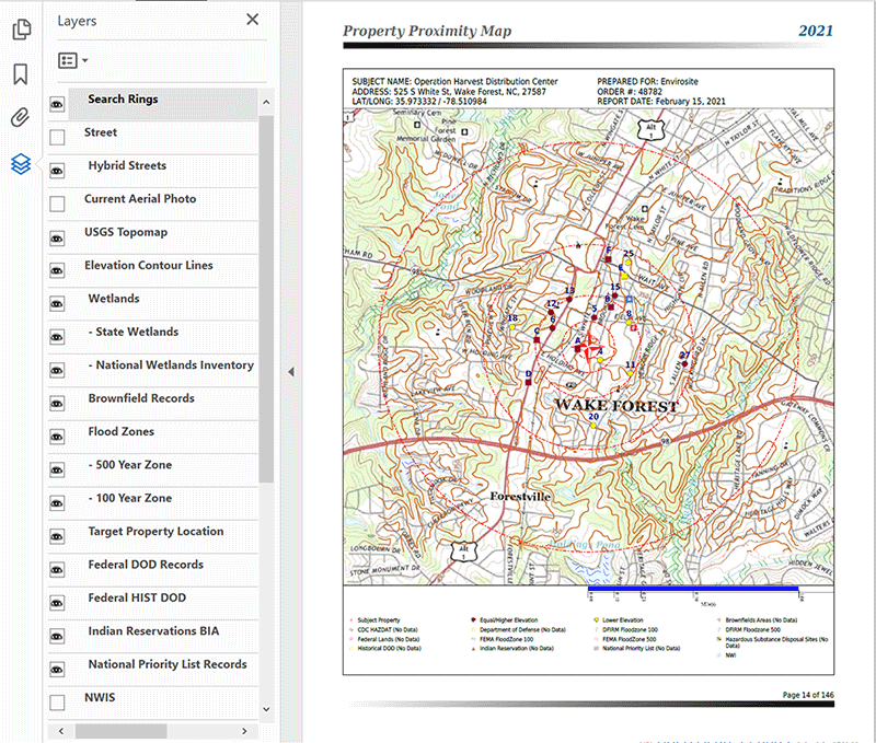
Our Interactive Reports Provide a Clearer Picture and Deeper Understanding of Potential Environmental Issues
Generate top-quality accurate site assessments with our newly enhanced solutions. Our Interactive PDF feature has been deployed across our product lines, improving reports and making it easier to find and assess potential property issues or concerns. This new enhancement helps environmental professionals develop the right conclusions and recommendations for their organization and clients.
Key Report Features
-
Displays Environmental Database Sites and Layers over a base map or current aerial image
-
Provides Standard Digital Flood Insurance Rate Map (DFIRM) database for improved flood data with higher accuracy
-
Improved Geocoding for more mapped sites and fewer “unmappable” sites
-
Provides Geospatial Clustering for better readability, particularly in areas with higher site concentration
-
Improved Report Bookmarks and Hyperlinks to site details on state agency websites
-
Saves Time by decreasing Environmental Site Assessment time up to 20 minutes
I like how much I can customize the reports to suit my needs. Being able to select the databases to be searched and customize the search radii makes review of the report much easier. The customer service is excellent. I am very pleased with my experience with Envirosite.
Senior Geologist, Midwest Consulting Firm
I use Envirosite due to their data quality and turnaround time. The hyperlinks for environmental records to state/local agencies for data access saves me time on file review, and their team is top notch and client driven.
Amy Wakefield, EnviroScience, Inc.
“Our company does a significant amount of corridor studies for linear transportation projects and Envirosite has always done a fantastic job for every project. No matter the project size, Envirosite has always met or exceeded our needs.”
Zach K. - Virginia
Honesty, Responsiveness, and Quality of the data provided were the key factors in our decision-making process to nominate Envirosite as our prime data supplier. It is very important to have a firm that fully understands the needs of accuracy, turnaround, competitive pricing and willingness to customize to client needs. Envirosite provided that and earned our business.
VP, Southeast Engineering Firm
The report layout is easy to read and the information is nicely presented in a usable fashion. The website was easy to navigate and having electronic copies of the reports with a quick turnaround time was great. Links within the pdf document were also helpful.
Environmental Scientist, Northeast Consulting Firm
“Over the weekend I had a little problem, I sent a message from the platform and had my final report early this morning. Envirosite delivered exactly what I needed. Envirosite did a nice job addressing my issues.”
David Turner, Turner Environmental